Alle Schlachten
 Source
 ![A view of the lines and Fort of Tcionderoga [e.g. Ticonderoga] taken from a hill on the side of South Bay in 1759. Topographical drawing shows Fort Ticonderoga, drawn from the South Bay of Lake Champlain in New York state during the French and Indian War. The tents marking military encampment are penciled in. REPOSITORY: Library of Congress Prints and Photographs Division Washington, D.C. 20540 USA.](https://upload.wikimedia.org/wikipedia/commons/7/73/Fort_ticonderoga_1759.jpg) Source
Source
Schlacht von Ticonderoga
1759 • New York Festungskrieg
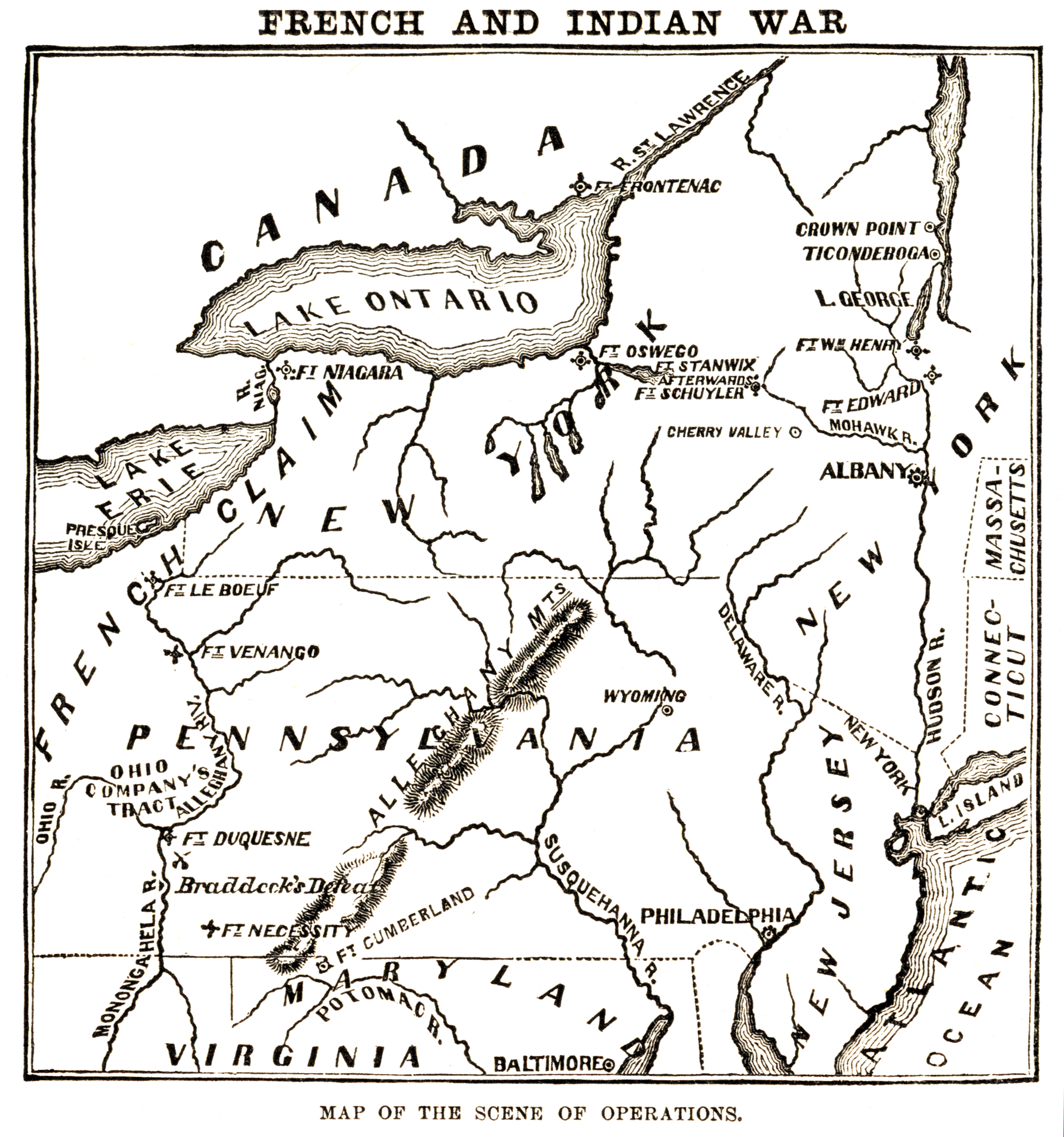
Map of the "scene of operations" of the en:French and Indian War.
Author: Harper & BrothersLicense:PD
A view of the lines and Fort of Tcionderoga [e.g. Ticonderoga] taken from a hill on the side of South Bay in 1759. Topographical drawing shows Fort Ticonderoga, drawn from the South Bay of Lake Champlain in New York state during the French and Indian War. The tents marking military encampment are penciled in. REPOSITORY: Library of Congress Prints and Photographs Division Washington, D.C. 20540 USA.
Author: Unknown authorUnknown authorLicense:PD
Historische Übersicht
Ein kleineres französisches Heer hielt eine massive britische Frontalattacke auf das Fort stand.
Fakten auf einen Blick
Ergebnis:Überraschender französischer Sieg; die Briten erlitten schwere Verluste bei frontalen Sturmangriffen.
Königreich Frankreich
- Befehlshaber: Montcalm
- Truppenstärke: ca. 3.600
- Verluste: ca. 400
Königreich Großbritannien
- Befehlshaber: James Abercrombie
- Truppenstärke: ca. 18.000
- Verluste: ca. 2.000
Strategischer Kontext
Versuch der Briten, über den Lake Champlain direkt in das Herz von Neufrankreich (Kanada) vorzustoßen.
Konflikt / Krieg
Siebenjähriger Krieg
Überragender preußischer Sieg.
Historische Orte
Die interaktive Karte erfordert die Zustimmung zu Drittanbieter-Cookies.