Battle of Artemisium

Battle of Artemisium
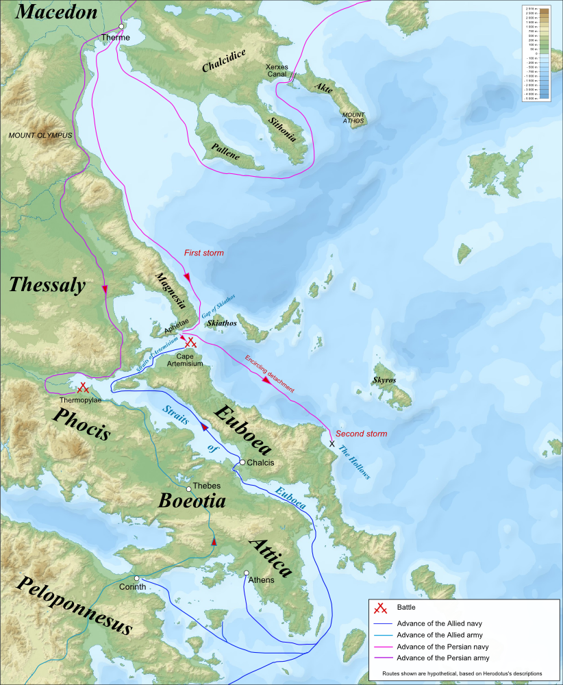
Campaign map for the Battles of Thermopylae & Artemisium (480 BC), based on the description of Herodotus. Imposed on a Bathymetic/Topographical map of the Aegean Sea. UTM projection; WGS84 datum ; shaded relief *Scales: **Topography: 1:608,000 (precision 152 m) **Bathymetry: 1:7,512,000 (precision 1,878 m)

Beach at Cape Artemisium on Euboea with Magnesia in the distance.

Beach at Cape Artemisium. Magnesia in the distance

Departure of the Grecian fleet for Thessaly

Disaster to the Persian fleet

Euboea's northern shore, the Hollows
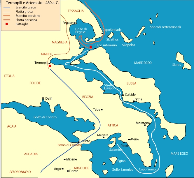
Termopili e Capo Artemisio
Historical Overview
Naval battle taking place parallel to the Battle of Thermopylae. The Greek fleet held off the superior Persian forces for three days.
Quick Facts
Greek Navy
- Commander: Eurybiades / Themistokles
- Strength: 271 Trieren
- Casualties: Hoch
Achaemenid Empire
- Commander: Xerxes I.
- Strength: ca. 800 - 1.000 Schiffe
- Casualties: Sehr hoch (Sturm & Kampf)
Strategic Context
Protecting the flank of the land army at Thermopylae and preventing a Persian maritime bypass.
Conflict / War
Persian Wars
Related Literature


Historical Locations
Interactive map requires third-party cookie consent.