All Battles
 Source
 ![A view of the lines and Fort of Tcionderoga [e.g. Ticonderoga] taken from a hill on the side of South Bay in 1759. Topographical drawing shows Fort Ticonderoga, drawn from the South Bay of Lake Champlain in New York state during the French and Indian War. The tents marking military encampment are penciled in. REPOSITORY: Library of Congress Prints and Photographs Division Washington, D.C. 20540 USA.](https://upload.wikimedia.org/wikipedia/commons/7/73/Fort_ticonderoga_1759.jpg) Source
Source
Battle of Ticonderoga
1759 • New York Festungskrieg
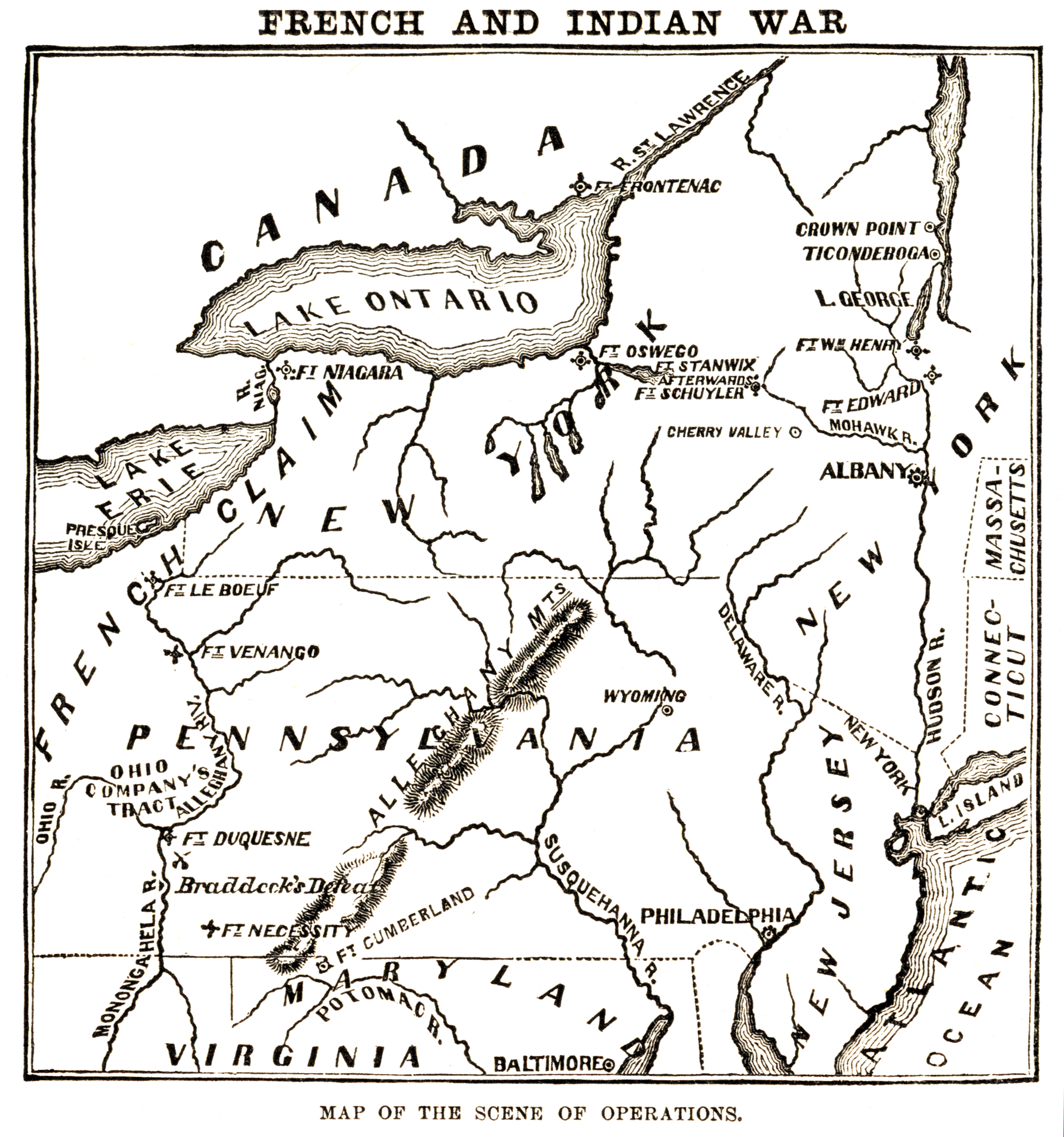
Map of the "scene of operations" of the en:French and Indian War.
Author: Harper & BrothersLicense:PD
A view of the lines and Fort of Tcionderoga [e.g. Ticonderoga] taken from a hill on the side of South Bay in 1759. Topographical drawing shows Fort Ticonderoga, drawn from the South Bay of Lake Champlain in New York state during the French and Indian War. The tents marking military encampment are penciled in. REPOSITORY: Library of Congress Prints and Photographs Division Washington, D.C. 20540 USA.
Author: Unknown authorUnknown authorLicense:PD
Historical Overview
A smaller French force repelled a massive British frontal assault on the fort.
Quick Facts
Outcome:Surprising French victory; the British suffered heavy casualties during frontal assaults.
Kingdom of France
- Commander: Montcalm
- Strength: ca. 3.600
- Casualties: ca. 400
Kingdom of Great Britain
- Commander: James Abercrombie
- Strength: ca. 18.000
- Casualties: ca. 2.000
Strategic Context
British attempt to advance directly into the heart of New France (Canada) via Lake Champlain.
Conflict / War
Seven Years' War
Overwhelming Prussian victory.
Historical Locations
Interactive map requires third-party cookie consent.